
SEPTEMBER 12, 2018
A series of significant tornadoes impacted portions of the southern U.S. during January 2017, with high-impact tornadoes affecting portions of the southern U.S. during the early-morning hours of the 21st…
The town of Hattiesburg, Mississippi was among areas hardest hit by this activity – with several tornadoes occurring in from east Texas to Georgia in the following days. In all 20 tornado-related fatalities and 207 injuries were reported, in addition to losses exceeding $1 billion. Much quieter severe weather was realized in January 2018, however, with only one significant (F2+) tornado recorded during that month.
“WeatherDeep L-model” Performance
The WeatherDeep L-model for Extended-range Severe Storm Prediction (described hereand hereafter referred to as the “L-model”) suggested widespread significant tornado activity during January 2017, with much quieter activity forecast for January 2018. For the January 2017 case, forecasts of significant tornado activity would have been available in real time approximately 15-20 days in advance of the Hattiesburg, MS and Albany, GA tornadoes.
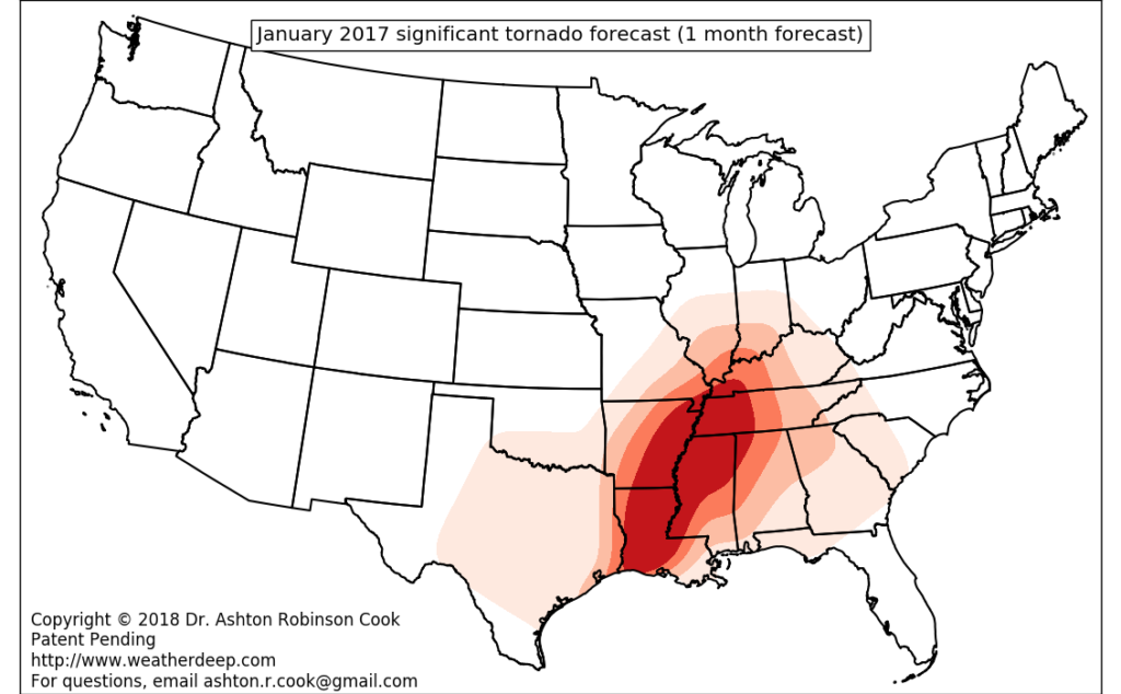
One-month forecast of significant tornadoes valid January 2017
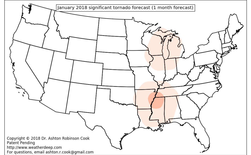
One-month forecast of significant tornadoes valid January 2018
Active tropics
WeatherDeep’s efforts for seasonal tropical cyclone landfall forecasts continue. An experimental 2018 forecast was generated in early June and the results are promising – particularly with regard to ongoing activity in the Atlantic. WeatherDeep continues with its policy of not publicly distributing it’s current forecasts, although more information can be made available upon request. Be on the lookout for additional information on tropical cyclone forecast efforts at the conclusion of this year’s hurricane season.