FEBRUARY 16, 2018
Skillful seasonal to yearly forecasts of severe storms (tornado, hail, and convective wind) are now a reality! In this and subsequent blog posts, I’ll be unveiling the fruits of my recent research, which has culminated in a platform for extended range severe weather outlooks and probabilistic loss guidance that demonstrate skill through 12-13 months.

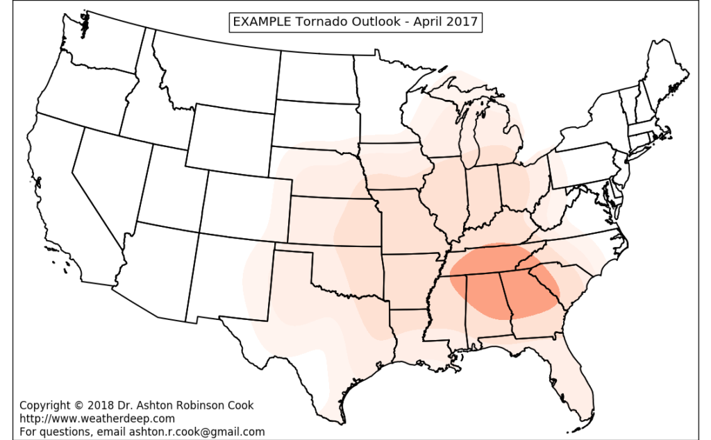
Sample four month forecast valid April 2017 (pictured above)
The foundation behind these outlooks are a series of machine/deep learning techniques that incorporate multiple larger-scale oscillations (including El Niño Southern Oscillation) to make severe weather predictions in localized areas. These predictions are:
- Monthly outlooks of tornado, hail, and convective wind for the Continental U.S. along and east of the Rocky Mountains
- Skillful through 12-13 months
- More skillful than climatology (which is commonly used in most catastrophe models)
- Able to identify higher-impact, “synoptically forced” severe weather events with multiple months of lead time
- Flexible, with potential for a wide variety of industry uses (including insurance/reinsurance/underwriting, resource/risk management, emergency management, disaster planning, etc.)
One of the key flexibilities of the model is its application to a relatively simple catastrophe model to produce probabilistic loss guidance. The table below indicates loss probabilities from individual perils at specific monetary thresholds. Monthly probabilistic loss curves are also available for specific regions and for the entire nation (east of the Rockies)…
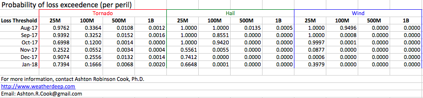
Above table: Probabilities of losses (from each individual peril) exceeding a specified threshold. For instance, model forecasts indicated a 32.52% chance of tornado losses exceeding $100 million in September 2017. Probabilities were derived from a catastrophe model applied to forecasts of tornado, wind, and hail generated in July 2017.
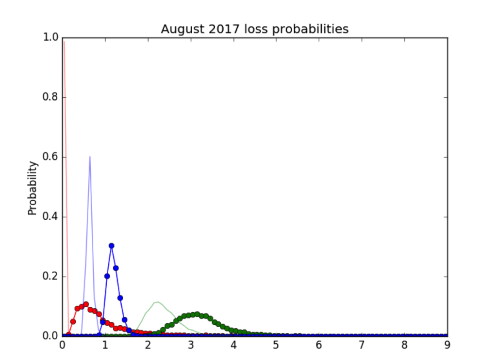
Above figure: August 2017 loss probability curves for each individual peril (tornado in red, wind in blue, and hail in green). Lighter curves are derived from climatology, while darker curves with circles are derived from model forecasts of severe weather activity. Losses are in hundreds of millions of dollars.
With these initial results showing a tremendous amount of promise, I’ve now reached the stage where feedback is necessary to increase relevance of new technology in various industry settings.
Here’s what I need from potential evaluators:
- Feedback from industry professionals who may potentially use the product, including information on potential benefits/uses and suggestions for improvement
- Confidentiality – especially regarding any 2018 sample products.
What I can provide to potential evaluators:
- Sample products for 2018 (including probabilistic loss guidance from tornado, hail, and convective wind)
- A more rigorous preliminary assessment of how the model performed in 2017
- Objective verification of past model output and comparison of that output to climatology
If you’d like to be selected as an evaluator of my new model or have any additional questions, please contact me by following this link.
In the upcoming days, I’ll be providing a review of major severe weather events that impacted the U.S. in 2017, along with a subjective view of how model output from the new technology fared in predicting these events. Stay tuned!!!